Last CNY was rather dreadful.
Having to soldier through heavy rain in our new clothes and shoes, while carrying oranges and angbaos, was not really fun.
If you were like us, you were probably praying for the rain to stop.
Good news is, it won’t rain as much this CNY.
Bad news is, you can never win in Singapore as this CNY will be hot.
Probably better than a wet CNY though – at least your angbaos will stay nice and dry.
A Hot and Dry CNY
Currently, the Northeast Monsoon conditions are prevailing, with the winds blowing mainly from the northeast or northwest.
Generally drier conditions can be expected in the first two weeks of February 2024.

During this fortnight, we can expect localised short-duration thundery showers over parts of Singapore on several afternoons.
A few days may be fair and warm, but there are expected to be some windy days in the second week of the fortnight.
The total rainfall for the first half of February is forecast to be near average over most parts of the island.
Due to less rain and cloud coverage, daily maximum temperatures are likely to be higher than what we experienced in January.
A high between 33 and 34 degrees Celsius is expected on most days, and may even reach 35 degrees Celsius on a couple days.
A Wet, Wet January
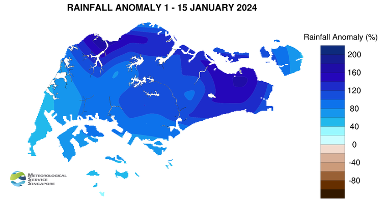
January 2024 was rather rather wet and cold as the Northeast Monsoon prevailed over Singapore and the surrounding region in the second half of the month.
Low-level winds blew from the northeast or northwest and thundery showers fell over parts of the island in the afternoon on most days, with showers extending into the night on some occasions.
The regional convergence of winds on 24 January brought widespread to moderate thundery showers over many areas of the island in the afternoon and night.
That day, the daily total rainfall of 146.2mm recorded at Kallang was the highest rainfall recorded for the month.
The daily maximum temperature in the second half of January largely ranged between 31 and 34 degrees Celsius.
The highest daily maximum temperature of 34.8 degrees Celsius was recorded at Admiralty and Jurong West on 21 January and 22 January respectively.
Above average rainfall was registered across Singapore in the second half of January, with Lower Pierce Reservoir recording a rainfall of 90% above average.

About the Northeast Monsoon
The Northeast Monsoon season typically starts with a wet phase from December to January followed by a dry phase from February to early March.
During the wet phase, there are usually short-duration thundery showers in the afternoon and early evening – the closest we can get to having winter in sunny Singapore.
Typically, we can expect two to four monsoon surges during this period, which refers to the steady strengthening of north-easterly winds blowing from the South China Sea.
These monsoon surges usually bring periods of prolonged widespread moderate to heavy rain lasting two to five days, with occasionally windy conditions and cooler temperatures.
After the wet phase, the generally drier and windier dry phase will commence. This dry phase is coming up soon, so you might be able to go out without an umbrella!


